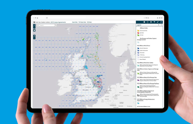
The NSTA is making more data available through its growing suite of interactive maps, reports and dashboards for the UKCS, facilitating better decision making and supporting the delivery of a holistic, interconnected energy system.


NSTA virtual map gallery tour
Take a look at some of our most popular and newest maps; and get some hint and tips on how to use them.